
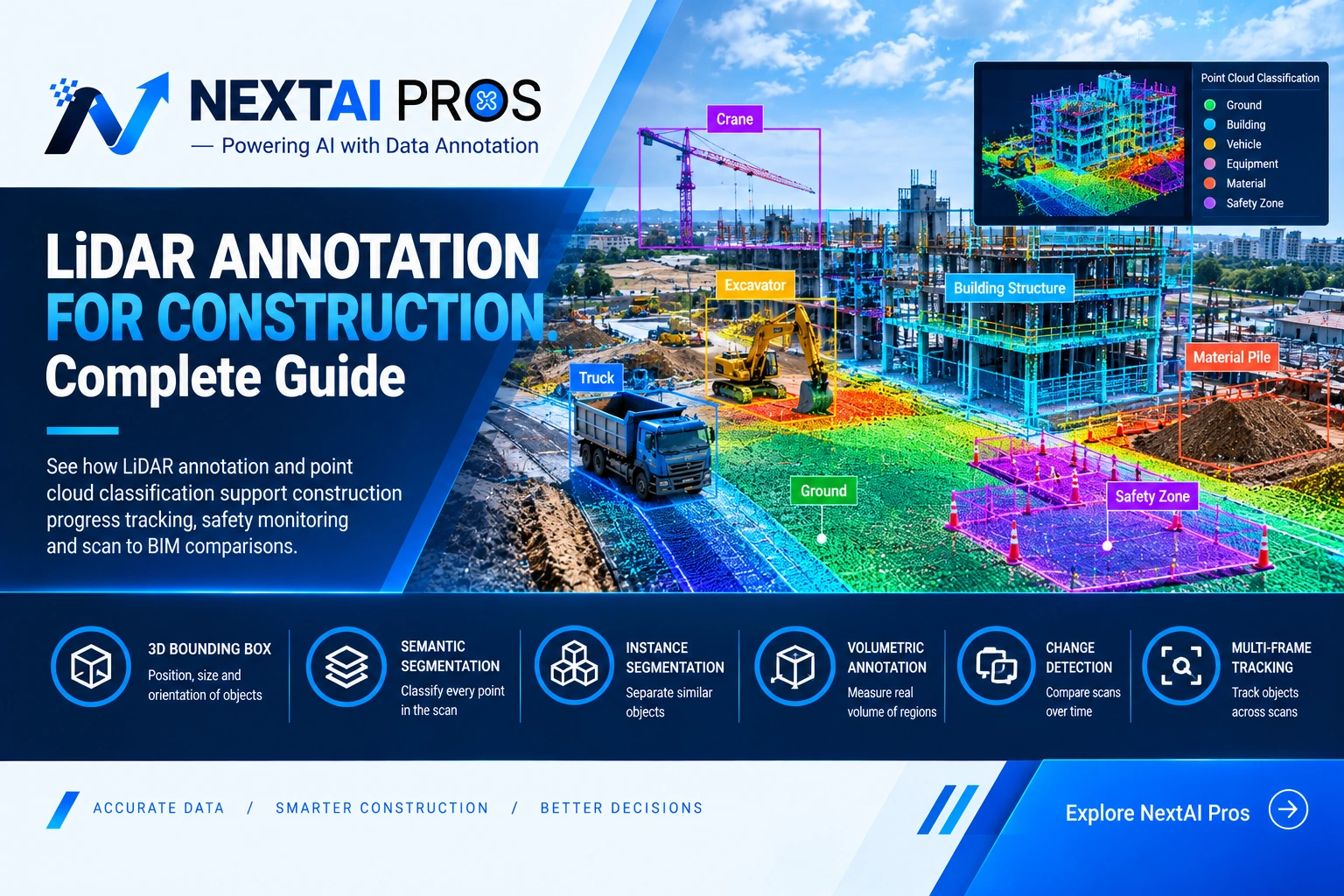
LiDAR Annotation for Construction: A Complete Guide to 3D Point Cloud Annotation
During a project of widening a road on the MoPac Expressway in Austin, a survey team can generate millions of laser dots in one go, but the laser dots do not include any label that defines what the objects represented by the laser dots signify. It is just a point cloud until the labeling process takes place. That classification work is LiDAR annotation for construction, handled by teams like NextAI Pros.
Sept 18 2026
LiDAR Annotation
What LiDAR Annotation Actually Means
LiDAR refers to Light Detection and Ranging, a technique of measuring distance using lasers based on the principle of detecting the time taken by light to return after bouncing off the target surface. During the scan, millions of points forming the point cloud appear in a 3D form on a construction site, each point being the exact location where the laser bounced off a real object.
LiDAR annotation is the process of labeling the point cloud via the process of classification of the point clouds into beams, pipes, piles of debris, and excavations. The process gives a way for artificial intelligence systems to easily identify any object within the scanned area by making comparison and analysis of the condition of the site.
What 3D Point Cloud Annotation Involves
The difference between 3D point cloud annotation and regular 2D image annotation lies in the fact that each point in the former has coordinates x, y, and z, whereas the points in the latter lie on a pixel grid. This makes the job of the annotator more interesting and challenging than usual. Not only do they have to draw a box around the object, but also define its location, size, and orientation.
Point density varies a lot across a real scan, and occlusion is a constant factor, a piece of equipment or structural element partially hidden behind another object still needs an accurate label even with only part of it visible in the scan. Sparse or occluded regions demand more careful judgment than clean, dense sections, and this is exactly where general image annotation training falls short compared to annotators trained specifically in point cloud data.
Common Labeling Approaches In Point Cloud Work
Construction and computer vision companies typically have a selection of several standard labeling techniques, each tailored for a particular type of object.
3D cuboid annotation involves putting a cuboid around a single object in order to capture its coordinates, size and direction of the object – mostly equipment, vehicles and material piles. Semantic segmentation is about labeling each point in a scan as a ground, wall, beam, debris. Instance segmentation labels each object separately, which means that, for example, ten columns are labeled as ten different objects instead of one. Volumetric annotation helps calculate the real volume of a certain labeled region – necessary for labeling of excavated soil or poured concrete. Change detection is comparing two scans of the same site made some weeks later in order to see the difference between them.
This labeling can be used in 3D object detection models for recognition of equipment, vehicles, constructions and other objects, and multi frame tracking can help label the same equipment or vehicle consistently across several frames.
Technique | What It Captures | Common Use |
3D Bounding Box | Position, size and orientation of a discrete object | Equipment, vehicles, material stacks |
Semantic Segmentation | A category assigned to every point in the scan | Ground, walls, beams, debris |
Instance Segmentation | Individual objects separated within the same category | Rows of identical columns, multiple pieces of equipment |
Volumetric Annotation | The measured volume of a labeled region | Excavated earth, poured concrete |
Change Detection | Differences between two scans of the same site over time | New structure, removed debris, shifted equipment |
Multi Frame Tracking | Consistent object identity across sequential scans | Equipment or vehicles moving across a site |
Why This Matters On An Active Construction Site
Once labeled, a scan supports the kind of construction site monitoring and construction progress tracking teams rely on week to week.
Comparing current progress against the original building information model, usually called BIM. Flagging equipment or material sitting too close to an open excavation edge. Detecting a structural element that’s out of position compared to the design plan. Identifying clearance issues between overhead lines and crane movement. Tracking how much material has actually been placed against what was scheduled, sometimes called excavation volume estimation when its earth is being measured. Spotting a trench or open pit that isn’t properly marked.
None of this needs dramatic detection work. It needs the same labels applied consistently, scan after scan, throughout a project’s timeline.
LiDAR and Camera Sensor Fusion
LiDAR rarely works alone on a modern construction site. Many construction monitoring systems pair point cloud data with standard camera footage in what’s called sensor fusion, layering visual detail on top of the spatial accuracy a laser scan provides. Before that fusion happens, LiDAR and camera data need to be calibrated so points and images align correctly, without calibration, a labeled object in one data source won’t line up with the same object in the other. A crack visible in a photo and a dimension measured in a point cloud tell a more complete story together than either does alone, which is why teams increasingly want both data types labeled, calibrated, and cross checked as one dataset rather than delivered separately.
LiDAR For Scan To BIM And Digital Twins
Scan to BIM is the process of comparing a classified point cloud against a building’s original design model to catch drift between what was planned and what actually got built. Recent work in this space has tied LiDAR annotation directly to BIM comparison, dimensional compliance checks, and ongoing safety monitoring, not just a one time as built survey at project close.
Digital twin platforms lean on this same foundation. A classified point cloud becomes the spatial backbone of a live digital model, and annotated camera imagery fills in surface level detail the laser scan alone can’t capture, like paint condition, signage, or material type.
How A Raw Scan Becomes Usable Site Data
Turning a raw LiDAR scan into something a project team can rely on follows a fairly consistent process. The team scopes the classification first, deciding whether the priority is structural elements, safety hazards, equipment, or a mix of all three. Labeling guidelines get written specific enough that a stack of pipe and a stack of conduit, which look nearly identical in a point cloud, still get classified the same way by different annotators. Annotators then work through the scan in specialized 3D software, tagging point clusters by category. The labeled scan gets cross checked against the original BIM or CAD model to catch any drift from the design, and a second annotator reviews the classification before it reaches the client.
Skipping that cross check against the design model is the shortcut that causes the most trouble later. A labeled scan without it shows what’s physically on site, but nobody catches how far it has drifted from the plan until it becomes expensive to fix.
Where This Plays Out On Real Construction Sites
A dense urban site deals with tight clearance problems, cranes, scaffolding, and street level equipment all crowded into a small footprint, where a few inches of drift matters. A highway project like the I 35 expansion through Dallas faces the opposite challenge, long continuous stretches of grading and drainage scan data that need the same classification standard held across miles rather than one tight site.
Progress tracking is usually the first reason a project manager wants labeled scans, weekly captures checked against the schedule to catch delays before they compound. Safety monitoring follows closely, since flagged hazard zones, exposed rebar, and unstable scaffolding can be identified automatically once the classification system knows what to look for. As built verification rounds it out, catching a structure that has drifted from its original design before it becomes a costly problem during inspection.
Construction LiDAR Annotation Quality Checklist
A few checks separate a dataset a project team can trust from one that quietly introduces errors into a report.
Every scan should go through a second reviewer before delivery, not just a single annotator’s pass. Labels should be checked against the project’s written guidelines so similar objects get classified the same way across the entire dataset. Where a BIM or CAD model exists, labeled scans should be cross checked against it to catch drift. Sparse, occluded, or low density regions, caused by dust, wet concrete, or reflective surfaces, need a documented approach rather than being left to individual annotator judgment. And the delivered dataset should come in a format that fits the client’s existing pipeline.
Where Automated Classification Still Falls Short
Point cloud classification tools have improved, but they still stumble on objects that look alike from certain angles, a coil of cable resting near a beam can confuse an automated system into mislabeling both. A trained reviewer is still the one deciding whether an odd shaped cluster is debris or a half installed component, catching a hazard an automated tool got wrong, and classifying an equipment type the software has never encountered before.
LiDAR Annotation Beyond Construction
The same point cloud classification skill carries well past construction sites. Autonomous vehicle teams use nearly identical labeling for 3D object detection and multi frame tracking, helping self driving systems judge distance and shape in real time. Urban planning departments use labeled aerial LiDAR to model neighborhoods ahead of zoning decisions.
How NextAI Pros Approaches This Work
NextAI Pros is a data annotation team with 8+ years of experience and 30+ annotators, delivering precision labeling across image, video, text, audio, blueprint, and 3D point cloud data, including LiDAR and 3D bounding box annotation. Work is done using tools like CVAT, Roboflow, Label Studio, Supervisely, and LabelMe, and delivered in standard formats including COCO JSON, YOLO, and Pascal VOC, backed by a triple level QA process aimed at 99%+ accuracy.
For construction and infrastructure teams that also need standard camera footage labeled alongside point cloud data, the same team handles that layer too, so a project ends up with one consistent, reviewed dataset instead of two disconnected sources.
Have a project in mind. Reach out at info@nextaipros.com or visit the contact us page to talk through what your site data actually needs.
Frequently Asked Questions
What does LiDAR annotation mean?
It means labeling 3D point cloud data captured by a laser scanner so software can identify objects, surfaces, and hazards within the scan, adding the semantic labels the raw geometry doesn’t carry on its own.
What is the full form of LiDAR?
Light Detection and Ranging, a scanning method that measures distance using reflected laser light to build a detailed 3D map of an area.
What is the difference between semantic and instance segmentation in point cloud annotation?
Semantic segmentation assigns a category to every point, like ground or beam. Instance segmentation goes further and separates individual objects within the same category, so similar objects each get their own label instead of one merged shape.
What is Scan to BIM?
It’s the process of comparing a classified point cloud against a building’s original design model to catch differences between what was planned and what was actually built, supporting dimensional compliance and progress checks.
Why does LiDAR and camera sensor fusion need calibration?
LiDAR and camera data come from different sensors capturing the world in different ways, so they need to be calibrated first to make sure points and images align correctly before they’re fused into one dataset.
What tools and formats does NextAI Pros work with?
The team works with CVAT, Roboflow, Label Studio, Supervisely, and LabelMe, delivering datasets in COCO JSON, YOLO, and Pascal VOC formats.
Can NextAI Pros handle both LiDAR and camera footage from the same project?
Yes, the same team covers standard camera footage alongside point cloud data, so a project can get both labeled and cross checked as one dataset.
At NextAI Pros, our clients are not just customers — they’re valued partners in every project. We offer personalized support to help you navigate your AI data journey, from choosing the right annotation approach to understanding your project’s unique requirements. Whether it’s answering your queries or providing expert guidance on data strategy and implementation, NextAI Pros is with you every step of the way.
Categories
- Image Annotation
- Video Annotation
- Text Annotation
- Audio Annotation
- LiDAR Annotation